- Home Page
- Fact Tours
Our sample tour itineraries of China and China travel packages are sorted by theme and available at competitive prices, you can browse what tours are right for you for your trip to China.
Popular China Tour Packages

Custom Tour Packages to China and Ask Our Experts for Free Enquiry !
- Coach Tours
- Destinations
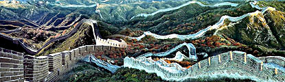
Beijing, the capital of China. Its art treasures and universities have long made it a center of culture and art in China.
Beijing Top Attractions
Beijing City Tours
Best China Tours with Beijing
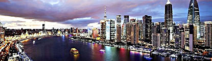
Shanghai, the cultural and economic center of East Asia. It renowned for its historical landmarks, the extensive and growing skyline.
Shanghai Top Attractions
Shanghai City Tours
Best China Tours with Shanghai
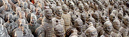
Xi'an, having held the position under several of the most important dynasties. It is the top destination to explore the facts of Chinese history.
Xi'an Top Attractions
Xi'an City Tours
Best China Tours with Xi'an
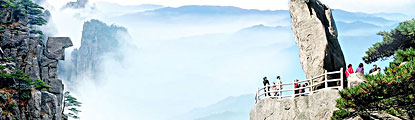
Huangshan boasts its culture, beautiful rivers, villages and mountains. It's home to 2 UNESCO World Heritage Sites and the Mecca of photographers.
Huangshan Top Attractions
Huangshan City Tours
Best China Tours with Huangshan
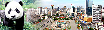
Sichuan is the cradle of the Shu culture, panda, mahjong, teahouse and spicy food. The province ranks first in China by number of UNESCO World Heritage Sites. It is called "the Heaven of Abundance".
Sichuan Top Attractions
Sichuan Tour Packages
Best China Tours with Sichuan
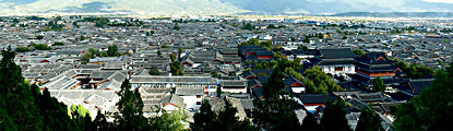
Yunnan, literally means the south of colorful clouds, due to its beautiful landscapes, mild climate and diverse ethnic cultures and traditions, is one of China's major tourist destinations.
Yunnan Top Attractions
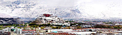
Tibet, the nearest land to the sky, is known for its breathtaking landscape, splendid culture, art, buildings, and mysterious religions.
Tibet Top Attractions
Tibet Tour Packages
Best China Tours with Tibet
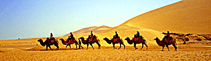
Explore the lost civilizations by riding a camel! Travel across the Gobi and the desert, and over the high mountains. Our Silk Road tours including different sections of the Silk Road in China.
Silk Road Top Attractions
Silk Road Tour Packages
Best China Tours with Silk Road
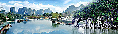
Guilin, an internationally-known historical and cultural city, has long been renowned for its unique karst scenery. Its vicinities are the paradise of hiking, caving, rafting, biking and countryside exploring.
Guilin Top Attractions
- China Facts
- China Hotels
- Travel Photos
About Us | Contact Us | Feedback
Powered by a China travel agency - Easy Tour China Tel: +86-773-3810160 USA/CA:1-888 666 0951
Site
Tours
Hotels
Design China Tour!
Not find a wish tour? Select from A La Carte. We do the rest on your interest!
Destinations


Home | About Us | Partnerships | Terms & Conditions | Privacy & Security | Payment Guide | Resource Links| Sitemap
Email: contact@chinafacttours.com, Tel: +86-773-3810160, Fax: (+86) 773-3810333
Copyright © 2008-2022 China Fact Tours. All rights reserved
![]()